


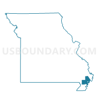
LEWIS 4 Voting District, New Madrid County, Missouri
About
Outline

Summary
| Unique Area Identifier | 609211 |
| Name | LEWIS 4 Voting District |
| County | New Madrid County |
| State | Missouri |
| Area (square miles) | 1.16 |
| Land Area (square miles) | 1.14 |
| Water Area (square miles) | 0.01 |
| % of Land Area | 99.05 |
| % of Water Area | 0.95 |
| Latitude of the Internal Point | 36.56343910 |
| Longtitude of the Internal Point | -89.61617890 |
Maps


Graphs
Select a template below for downloading or customizing gragh for LEWIS 4 Voting District, New Madrid County, Missouri


Neighbors
Neighoring Voting District (by Name) Neighboring Voting District on the Map
- LAFONT 1 Voting District, New Madrid County, MO
- LEWIS 2 Voting District, New Madrid County, MO
- LEWIS 3 Voting District, New Madrid County, MO